
I’ve got an aching gap. Not a medical condition, but a gap in my completed sections line, from Bootle to Ravenglass. This grates, like a piece of grit in my shoe. I don’t like leaving gaps like this unplugged, but the route for that section requires me to wade through the river Esk, and you can only do that at low tide. This weekend the time I’d arrive at the river is high tide, so I decide that living with a piece of grit in my shoe is marginally preferable to being swept out to sea, and so the ache remains, and today’s walk starts at Seascale.
The weather this weekend is fabulous, cold but sunny, the best for months, and lockdown Mk II is over. So I’ve decided to walk two sections, from Seascale to St Bees and then tomorrow on to Harrington (which is a suburb of Workington). I arrive at St Bees railway station to get the train back down to Seascale, and the sun welcomes me, through the winter branches of this fine old tree.

It’s not the only welcome I get. Like many times previously on this adventure, I feel I’m being watched…


It’s a pleasant, quiet village. People are out doing normal villagy things… tidying their gardens, out for strolls, walking their horses…

The train promptly arrives in Seascale. A few wispy clouds remain, but it is set to be a wonderful day.

I follow the road round under the railway line to pick up the path heading northwards. In the car park at the sea front is a memorial to the twelve people killed by a gunman around this area in June 2010. Early on the morning of 2nd June of that year, the killer visited his twin brother and shot him dead, followed by his solicitor, then a fellow taxi driver he had disagreements with. He then randomly killed and injured other people he encountered along his crazed travels through the towns of Frizington, Whitehaven, Egremont, Gosforth, and finally Seascale. For such violent and tragic events to happen in such a small community was very shocking.

A plaque has been mounted to remember those killed and injured. Perhaps underneath a cannon is not the most appropriate site for it, and it is a shame the names of those people tragically killed are not listed, but it is important that we remember, and learn, from these sort of events. Have we learnt? Britain’s gun laws were not changed after this event, and the killer legally held a shotgun and a rifle. I guess compared with America where these sort of events happen almost monthly, the UK is a very safe place.
The path leads north past a small boatyard, and onto the beach. The sun has brought many families out, children are splashing in the puddles and dogs racing to collect sticks thrown by their owners, for reasons only fully understood by the mad brains of dogs.


I stroll along the firmer sand at the bottom of the beach where it’s easiest to walk, occasionally looking for nice shells, and just revelling in being out of my flat and in the open air after four more weeks of lockdown, which had followed several weeks of Tier 3 lockdown… which followed months of semi-lockdown that followed the first full lockdown. Manchester has been a very restrictive place to live this year.

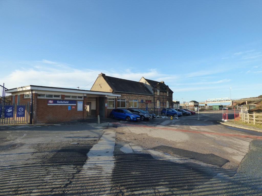
The beach comes to an end where the River Calder meets the sea next to Sellafield Nuclear Power Station.

A strange glass dome is set on top of a concrete pillar, just visible in the centre of the picture above. I peer into it and see a small stream joining the river from the south. Quite why this dome is here I have no idea, since the stream joins the river just a few yards further on. What strange device is this? Is it nuclear?

The footbridge runs on the landward side of the railway line, so requires me to pass underneath the railway bridge first.

Luckily a footbridge accompanies the railway line over the river, a relatively rare indulgence to walkers.

I’m now at the southwestern tip of the power station, and a high fence borders the site, topped with rolls of razor wire, and with frequent signs warning about the consequences of trying to break in, or fly drones anywhere near the site. Inside are several railway wagons, atop which sit large white steel boxes for transporting nuclear waste. I’m about to take a photo of them when I remember my run-in with the MOD Police back in Barrow. Not wanting to complete my collection of detentions by Civilian Special Police Forces by encountering the Civil Nuclear Constabulary – especially as this lot are armed – I change my mind and leave the photo untaken. Here’s a picture looking not into the nuclear site, not of a nuclear waste wagon.

If you’re desperate to know what these wagons look like, here you are…
Sellafield seems a very different kind of nuclear power station than Heysham. Heysham was clean and orderly. Sellafield is a monster that has grown inexorably from its beginnings in 1947 as a factory for producing plutonium. I wonder why there are no pylons carrying cables from the plant as there are at Heysham, but discover afterwards that there is no electricity generated here anymore. This site is now only for fuel reprocessing and waste storage, and the reactors are being decommissioned, a process due to last until 2040. The storage will continue for several millennia after that.
In my blog for the section past Heysham I regaled bored you with my views on nuclear power, from the viewpoint of an Electrical Engineer (no, not an electrician, I’m an Electrical & Electronics Engineer, sore point! 😉🤣). Of course the site here was never designed from the outset to generate power, but primarily to manufacture plutonium for the UK’s nuclear weapons (which is nothing to do with electrical engineering), but it was the site of the first Magnox reactor, and the first Advanced Gas-cooled Reactor which did generate electricity for 40 years or so. However, because of the military link, all commercial and financial considerations went out the window, and accountants creatively calculated that nuclear power was commercially viable. To do this they had to ignore the cost of 300,000 years of lethal waste storage that we pass on to our children and great great……great grand-children. I guess anything can seem cheap if you ask the next 400 generations to chip in. I wonder if any loan companies will let me buy myself a new car that way…..?

The path ends at Sellafield Railway Station. The route of the Cumbrian Coastal Path used to continue along the coast, but that is now closed to allow the installation of a new facility in the nuclear plant. The new modules for the facility are being shipped to Sellafield, dragged up the beach and into the site. To achieve this they’ve had to build new earthworks near the beach, build a new bridge over the River Ehen, and improve the railway level crossing. Then they’ll re-open the path. The whole project is going to take four years, but I don’t know when it started so I don’t know when it’ll end. Probably never.

The road up from the station is adorned with regular splashes of golden yellow gorse, resplendent in the winter sun. Unfortunately in the cold air of winter it doesn’t give off its gorgeous coconut-honey aroma.

At the eastern end of the site stands the old Windscale Pile. This was the first reactor built in 1950. It is now in the process of being dismantled, and a crane is firmly attached to its side, dismantling it bit by bit.

Given that this was the site of a serious fire in 1957, in which huge quantities of radioactive material were released through this chimney, I really wouldn’t fancy that crane driver’s job. 63 years is not very long at all in the half-lives of much of the stuff that came up that chimney.
Atop this chimney once sat filters which were put in place under the direction of John Cockroft, director of the Atomic Energy Research Establishment at the time, and which prevented a serious disaster becoming a cataclysmic disaster. The following section describes what happened, if you’re interested.

On a visit to a reactor in the United States in 1950, Cockcroft found that uranium oxide particles had been detected in the local vicinity. He was alarmed enough to order that air filters be installed in the chimneys at Windscale, but as the first 70 feet of the first chimney had already been built they had to be placed at the top instead of the logical place at the bottom. 200 tons of steel, bricks, concrete and equipment were hoisted to the top of the 400-foot chimneys, giving them their distinctive top-heavy appearance. Other engineers and scientists were unimpressed by the need for them, and they were mocked as “Cockcroft’s Follies”.
Seven years later, while performing a standard regular annealing process, one of the fuel rods overheated and caught fire. Initially orange flames were seen, which then turned blue as the graphite control rods caught fire. With the control rods damaged, workers started pushing the fuel rods out of the back of the reactor with metal bars, and eventually even with scaffolding poles. Carbon dioxide was used to try to extinguish the fire, unsuccessfully, then hundreds of tons of water were poured in, which eventually put out the fire. There was a release to the atmosphere of radioactive material that spread across the UK and Europe, which was all hushed up at the time of course, so well that even with 11 tons of uranium ablaze for three days, and with the reactor close to collapse and radioactive material spreading across the Lake District, the people who worked there were expected to keep quiet and carry on making plutonium for the bomb.
John Cockcroft’s filters atop the chimneys stopped a lot of the radioactive material escaping into the atmosphere. His “folly” turned out to be a prescient gift to the nation. It was also thanks to the courage of deputy general manager Tom Tuohy that the Lake District is still habitable today. When all else had failed to stop the fire, Tuohy scaled the reactor building and stared into the blaze below to check the water was successfully putting out the fire, taking a full blast of the radiation in the process.
Although no-one died in the fire itself, including amazingly Tom Tuohy who lived to the ripe old age of 90, it is estimated that approximately 170 local deaths occurred from thyroid cancer due to the release of radioactive iodine-131 over the decades that followed.

There is a plaque in memory of the people who fought to prevent a larger scale disaster, which was laid on the 30th anniversary of the fire, which another coastal walker – Helpful Mammal – found on his walk past here. I looked out for it but didn’t spot it. Apparently it went missing in 2017 when work was done on the perimeter fence, but turned up later that year lying at an angle in grass along a road near to the old reactor. So much for “we will always remember“.
A little past the Sellafield main gate, the route turns left down a small lane towards Tarn Head Farm, and past an abandoned cottage.

Looking eastwards, the peaks of the Lake District are enswathed in a coating of snow that fell last night in the coldest snap so far this winter.

The track reaches a fork where the Route 72 cycle track heads north, but I’m taking a narrow overgrown path southwards back towards the coast.

In the near distance to the north sits Braystones Tower, a Grade II listed building built to commemorate the Diamond Jubilee of Queen Victoria. It is in the process of restoration by the farmer who owns the land on which it sits, and who used to frequently climb it as a kid.

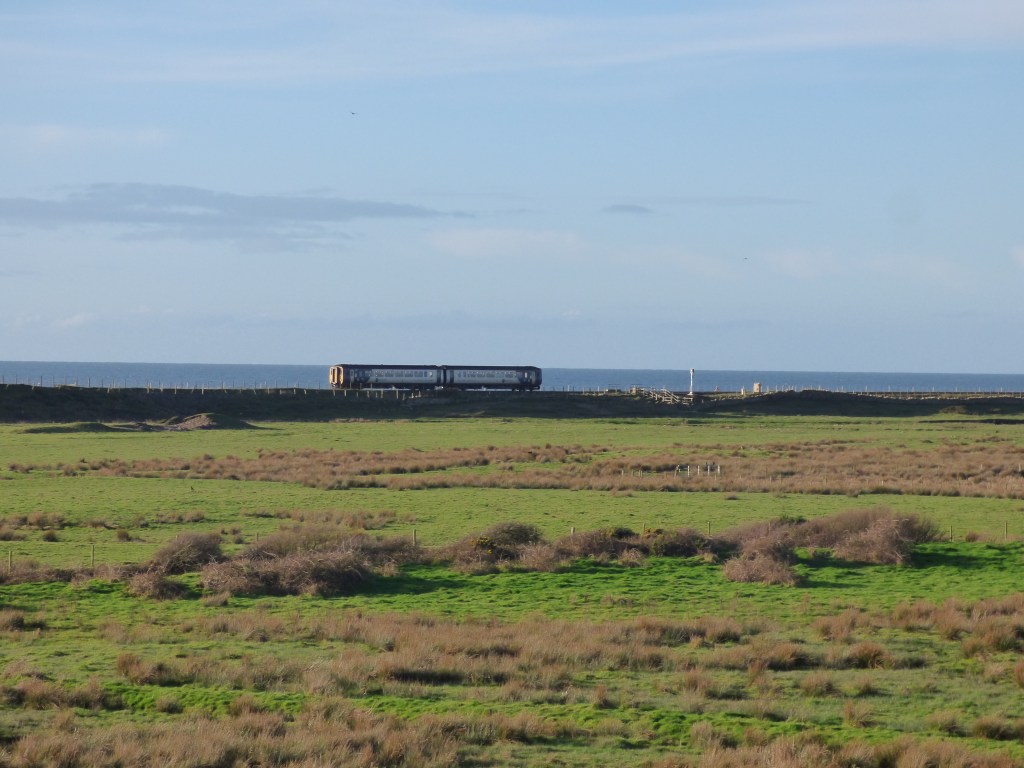
A train trundles along the coastal line, and shortly my path reaches the railway line where it passes over the River Ehen. Thankfully the bridge has had a footpath laid alongside the rails – that’s two today!


The path then performs a loop underneath the bridge to bring me out onto sand dunes, where motocross riders enjoy skidding round the deep sand.


It’s getting close to midday, but this late in the year the sun hangs low in the sky, kissing the calm, cold waters of the Irish Sea.

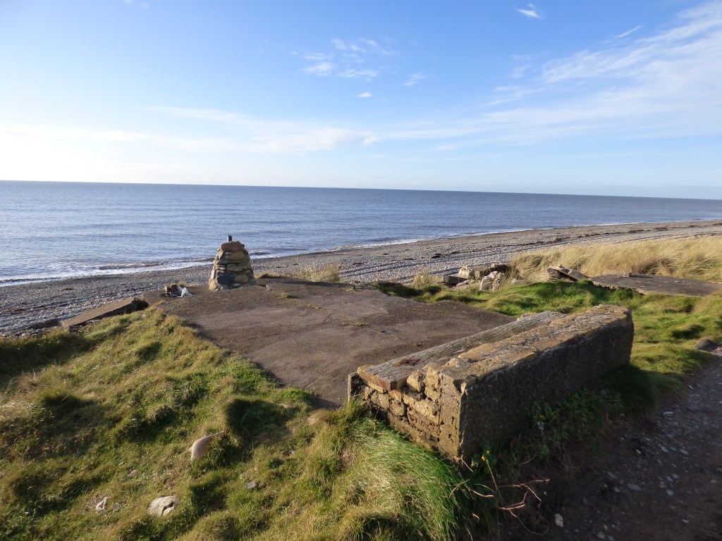
The path leads through the dunes parallel to the coastline. A relic of WW2 windowlessly gazes out to sea, it’s gaze assisted by a little chaffinch (I think) sat on the fence….

I come across a strange memorial to someone called Vikki, with the inscription…
Park your bum upon this rock
And stare across the sea
But if at times things get too much
Just scream and you’ll be free.
Err, yeah ok.
My reverie is broken by a train that comes rumbling behind me, just yards from where I’m standing.

A scrap-art sculpture on the beach catches my attention. I can’t say I like it, but I guess that gathering junk from all over the beach and assembling it in one place makes it easier to tidy the beach at some point in the future. I can’t think of any other good reason for this, certainly not aesthetical reasons. There are quite a few of these scultpures appearing on beaches these days.

I’d like them more if they actually looked like something. I remember some great sculptures back near Ulverston that I passed. Here’s one of them…

A car comes towards me making a terrible noise – I guess the exhaust is blowing a bit. I move aside to let it past and the driver acknowledges me, but I don’t think too much about it. About 20 minutes later the car comes back from behind me even noisier. I then notice there’s no back window and the exhaust is now hanging off, bouncing on the ground. The driver attempts some doughnuts in the deep sand, not very successfully, then drives off through a tunnel under the railway to a static caravan park. The car’s a total wreck, but it’s still four years younger than mine!

The path continues past a series of what look like jack-built houses at the top of the beach, next to the railway line, called “Lowside Quarter”. There must be thirty or forty of these, in various building styles – static caravans, corrugated iron & asbestos, wood, and brick. They remind me of the “Black Huts” village at Lowsy point that I passed just north of Barrow. Apparently, there have been huts on the beach here since 1910, where planning permission was first approved. Locally they are referred to as “beach bungalows”. There’s more information about them here.


Some have fared less well in this harsh environment, fronting storms off the Irish sea…

The beach is heavily pebbled at this point, and after the last “beach bungalow” the track disappears and I’m forced down onto the pebbles. Deep, loose, energy-sapping pebbles, for half a mile or so. This is really tough going, and having not done any walking for quite a while I really suffer at this point.

I sit down on a rock with curious striations, and eat a couple of sausage rolls.

I bought some posh hog roast sausage rolls from Aldi, but I’m not sure I like them very much – they’re a little bit sweet. I get through one and a half, but then throw the remaining out onto the beach, where gulls appear from nowhere and swoop down on them. The gulls spend so much time fighting each other that they seem almost distracted from the task of eating, reminding me of the geese that live in the marina near my flat. Argumentative buggers.
Eventually the pebbles come to an end and I walk up a ramp from the beach and onto a proper lane that swings to the right, over the railway, and into the village of Nethertown.

The next few miles pass along pleasant country lanes, with frequent views over the fields to the sea and the setting sun. Much of this is gradually downhill, which is a blessing considering how knackered I am at this point.


It’s been a long time since I walked any further than to the corner shop, and I’ve got a 13 mile walk lined up for tomorrow. I admit I’m having reservations about that considering how I’m struggling with just 10 miles today!
After a couple of miles a path leads down to the sea again, and I get my first unobstructed view of St Bees Head.


Just as I think I’m nearly there, I realise that the village of St Bees is actually over another small hill. I’ve got a choice, I can go along the flat but very pebbly beach, or over the top of the hill…

Hills are much easier than pebbles, so up I go. The path is quite muddy, and just as I start descending my feet slip from under me and I crash down onto my side, my camera smashing onto my hand. Bloody hell that hurt! When I was a child I was always falling over, falling off my bike, falling out of trees, and I just bounced – it didn’t really hurt. Now I’m 54 even relatively gentle falls like this knock the wind out of me. I’m perfectly fine, apart from a bruised hand (which saved my camera) and a coating of mud, but it takes me quite by surprise.
I look up to the sky and see a single jet plane cruising through the empty blue sky.

From the top of the cliff, and with the sun now getting very close to the horizon, a red tingle touches everything around me, and it feels very Christmassy. That reminds me, I’m going to put my Christmas decorations up in my flat on Tuesday night. That’s something to look forward to.


I pass an old standing stone, with some broken pieces of pottery at the base. I can’t make out any writing on the stone, and have no idea what the broken pottery represents. It’s getting popular these days for people to leave memorials all over the place. A spot like this is perfect for it, for people to come and sit and watch the sun go down over the water and think about the loved ones they’ve lost. I guess it’s much nicer than visiting a grave in a cemetery.

The path comes out onto a concrete base where perhaps a building once stood, and then onto the car park at the seafront at St Bees.
This is where my coastal walk ends, but unfortunately my car is parked half a mile away up in the village, so I have to trek back to St Bees station to collect it.

Right next to the station I encounter a statue of St Bega next to a tiny boat.

I thought I felt a drop of rain earlier, and St Bega checks it out too, but I think it’ll stay fine for tomorrow. St Bega seems to be quite a sturdy woman, she must have had to wrap herself around the mast of that boat to avoid capsizing. That can’t have been too comfortable for her journey all the way across the Irish Sea. I’ve recently done that journey on a Stena ferry and it wasn’t too comfortable in the force 6 winds, so she must have been quite some woman to have done it in a basket.
According to the story, Saint Bega was an Irish princess in the 9th century who highly valued her virginity but was promised in marriage to a Viking prince who was the son of the king of Norway. So instead of marrying the prince, who undoubtedly had designs on her virginity, she fled across the Irish Sea and landed at St. Bees. Here she settled for a time leading a pious life in a cave, but then pirates started raiding the coast, and fearing her virginity was again at risk, she moved to Northumbria, where she apparently went to Hartlepool – not renowned as a safe haven for virginity then or now for that matter – so she (maybe, but probably not) founded Hartlepool Abbey which had a wall around it to keep the local hooligans out.

Most of this is probably untrue, having been made up by various people, from the author of the 13th century “Life of St Bega” through a 15th century “Book of Hours” and 16th-century “historian” John Leland, up to 19th-century local historians that had shares in the local tourist industry.
In 1980 the historian John Todd bucked the trend by attempting to tell the truth about the tale, but luckily this unwelcome tide of veracity was promptly turned by Melvyn Bragg, who wrote a long and detailed history of her life, entirely made up. Well done Melv.
This walk was completed on 5th December 2020, and was about 9¾ miles long. Here’s the real-time recorded map of my actual route, in which you can pan and zoom around…:
Congrats on going where most don’t. A fascinating coast and post.
Those birds early on were the Covid-19 police checking on people from tier three regions out and about.
You made the Sellafield coast look scary, as it should.
Looking forward to tomorrow’s walk.
BC.
Thanks BC. I later shot those bloody birds, so no problem there👍😊
Another enjoyable write up thanks, and nice to see you back out on the coast again. You seem to notice more than I do, like that plaque of a shooting underneath a big gun, for example (what were they thinking). I think I also had to take the diversion at Sellafield and don’t remember if I took any photos of it now, I’ll have to check. Though I didn’t get arrested so probably not. I’m beginning to sense it’s a rite of passage for coastal walkers to be stopped by the police at some point (it happened to me at Liverpool docks). I loved St Bees, a beautiful little village with a lovely beach.
I stuck to the beach through Braystones and Nethertown though it was hard work with all those pebbles.
How did you manage to stopped at Liverpool docks Jon? Did you walk right through their main gate?🤣
St Bees is very nice, yes. I liked it. The following day I was hanging around the sign at St Bees indicating the start of the coast to coast route, waiting for someone to ask me if I was doing that, so I could answer “sort of, but the long route” No-one asked me!😁
That was very brave of you continuing on those pebbles – they really were a killer! Nearly as bad as the ones just a little further south near Bootle.
There is a (public) road (Regent Road, the A5036) where the docks become increasingly derelict and abandoned. It’s not the nicest of areas. When walking through there I was passed a few times by a white car. It was the weekend and it’s an industrial area so there is very little other traffic.
When I reached the main road where it becomes a dual carriageway (A565) this car pulled up in a bus stop alongside. It was an un-marked car and they asked what I was doing as they had seen me walking through the docks with a map and camera (I was using a big SLR camera). I told them I was walking to Crosby (which was true, but I was going further than that). They explained there had been some issues with people trying to break into the docks (or that is what I was told) and there had been some thefts so I presume they thought I was “casing” the area to try and find a way in or something. Anyway they seemed happy with my explanation and left me alone after that.
Sorry I should add, an unmarked police car (they did show me ID when they stopped).
I remember that area well – yeah, it’s dodgy as hell!
Anther excellent write-up. you are now beyond my own furthest north on that trek. I am wondering how you will handle the section further north to Carlisle after you run out of railway stations.
Thanks Conrad. I guess I’ll have to go back to using the bus. Absolute worst case I’ll have to get that bloody folding bike out again!😳
It’s OK there is no need for the bike. There is a bus 🙂
Glad you are going to ford the esk. The walk bootle to Ravenglass is short and the Roman baths and narrow gauge railway are fun.
Yes, it’s only 6 miles if I ford the Esk. I’ve been on holiday to Ravenglass before (at Muncaster Castle) so know it quite well. One of the rare “nice bits” on the Cumbrian coast!