
I wasn’t particularly looking forward to this section, as a lot of it is road walking. Some people don’t mind walking country lanes, but personally I find it dreary. At least the first 4½ miles is off-road and a lot more interesting.
I drive to Newton Arlosh and park the car outside the village church, then ride my lovely new electric bike the 9 miles to Silloth. I chain the bike up to the gate of the public toilets, which I guess will be OK as they’ve been closed since July. Hope no-one’s too desperate…

The weather is forecast to be mixed today. Showers and sunny spells. I look westwards over the sea, where a faint rainbow arches across the Solway. Sums it up.

Just a hundred yards away, sat on the closely mown seafront lawn stands the East Cote lighthouse.

Apparently, it was once sat on tracks so it could be moved about, as the best shipping channel into Silloth changed with the shifting Solway mud, but it’s fixed in place now. The lighthouse that is, not the mud. It goes into my collection of lighthouses.
It’s a pleasant amble along the promenade, with the sun occasionally poking through the clouds, although the sea is a murky brown for some reason. Not very enticing given the news this week that the water firms still pump millions of gallons of raw sewage into the rivers and sea. Urghhh.

In the distance, over the Solway Firth, individual buildings in Dumfries and Galloway are distinct through the autumn haze. The glowing white buildings of factories in Newbie, and further back the brutalist boxes of Chapelcross Power Station… like colossal nuclear robot heads of border reivers staring menacingly towards England…

Given the reason they were built was to manufacture weapons-grade plutonium, their intent is even more menacing than their look.
Far nearer, a concrete jetty stretches out a little into the sea. Now you may know by now that I have a thing about piers and my plan to tick off every one of them around the coast. This one barely fits the description, but what the hell, it’ll only take 30 seconds to get to the end.
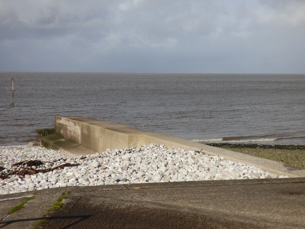
Beyond the concrete, a line of wooden posts emerges from a small mass of rocks, stretching out to a navigational marker. That wasn’t very exciting as piers go.

The route continues northwards along a pleasant clipped grass promenade until I arrive at the small village of Skinburness.


It’s a harrowing name for a quiet little place. Was it named after a site of an ancient torture chamber perhaps, established to punish the brutal Scottish reivers that frequently pillaged these northern Cumbrian settlements? And it seems that wasn’t the only form of torture practised around here….

No, but the real reason is scarcely less bloodcurdling. Apparently Skinburness means ‘The headland of the demon-haunted castle’. And Dicktrod Lane means….
Well, there’s no castle that I can see around here anymore, so I think I’ll get through safely.
The area around Skinburness was made habitable around 1100AD when monks from the nearby Holme Cultram Abbey cleared the marsh and scrubland for farming. Well, I don’t suppose they did it, as they were too busy praying and doing monky sorts of things. I guess they told other people to do it for them. As the village developed a small port was built to export wool, fish, grain and salt, mainly to Ireland and the Isle of Man.
The lovely grass promenade ends abruptly, and a path then threads its way between the sea defence boulders on my left and the back gardens of the houses of Skinburness.

At the end of the path, hidden amongst the trees, lies an old mansion now called Chichester Hall. It was built by Edwin Hodge Banks (well, again, like the monks, he probably got someone else to build it for him). He was a bit of a chancer from nearby Wigton where his family owned a small cotton mill.

He called it Chichester House, and he enjoyed an extravagant lifestyle here by the sea, with his 30-foot steam yacht moored nearby, until he was declared bankrupt in 1889 and had to make a quick exit from Skinburness before any of his creditors could catch him and burn his skin. Or tread in any painful places.
It then became home to the Carter-Woods family, whose son Joey, a talented artist, was killed in World War I. Their daughter Florence moved to Newlyn in Cornwall to join Joey in the artists’ colony there, where she married the artist Alfred Munnings. It was an unhappy marriage that ended with Florence’s suicide. The story is told in the novel “Summer in February” by Jonathan Swift and was made into a movie in 2013, apparently. I wouldn’t know because I’ve never watched it. Or read the book.
Beyond Skinburness the narrow promontory of Grune Point points its finger north-eastwards over Moricambe Bay. That is Moricambe Bay, not Morecambe Bay! The route passes over a pebbly beach, grassy patches, and then a stony-sandy beach.

Apparently, there was an ancient fortification around here. Roman Milefortlet 9 stood directly north of the village and later a chapel was built on the same site, supposedly the Green Chapel where King Arthur’s nephew Sir Gawain met the Green Knight. That seems unlikely to me as it’s a hell of a long way to come from Tintagel Castle in Cornwall just for a meeting, even with a green man. And that was before the M6 was built…. although the route might have been quicker then than the M6 is now. And he wouldn’t have had to get through Birmingham.
It was also used as a location by Sir Walter Scott in his novel Redgauntlet, which he wrote while staying in Skinburness. It’s all just sand and shingle now.
Tides and waves from each side of the peninsula meet at the very pointy end of Grune Point…

Grune Point is classified as an Area Of Natural Beauty. It’s OK I guess, but it looks better from the air…

Across the water is the spider-web of Anthorn Radio Station. Don’t bother trying to tune in, because the music’s crap. It only transmits radio navigation signals, the national time signal, and highly encrypted beeps and pips to the nuclear submarine fleet. It’s got a beat to it, but not much of a tune. Just like Little Mix.

Rounding the point, the expanse of Skinburness Marsh opens up before me. Gulleys and creeks snake through the marshes, trickling into Skinburness Creek, where oyster-catchers and gulls forage for grubs in the mud.


Heading southwards now, the marshy beach becomes a track, which then becomes a road, and I emerge back in Skinburness – Grune point is barely 300 metres across at its widest. I’ve only come four miles so far, but my legs are feeling very heavy today, I don’t know why. I’ve got another 10 miles to go so I’d better stop thinking about it!
A line of old houses stare out across the marsh, captured in this old 1920s photo, and my equivalent new one…


The house in the centre of the old photo, hidden by trees in the new one, is Marsh House, which looks like this now…

It was a nice big house, which was up for sale recently and looked lovely inside, but then burnt down in 2020. Shame. I like the arched window on the left, which seems a popular architectural feature around these parts.
A bigger and more exciting story of architectural disaster here was The Inn Of Insolvency – The Skinburness Hotel. Our chancer Mr Edwin Banks of Chichester House fame, built it as the Skinburness Marine Hotel in the 1880s (he didn’t build it). It enjoyed a brief opulent period until Dodgy Eddie went bankrupt and scarpered. After spending sixty years in government service as part of a liquor control program, it proceeded to bankrupt its next two owners, until an experienced hand managed to keep it open for a full 10 years. Its next owner was duly bankrupted. It closed for good in 2006 and was demolished in 2017. In 2016, a couple of guys broke in and explored the rotting hotel, and posted their video on YouTube, it makes a fascinating watch.


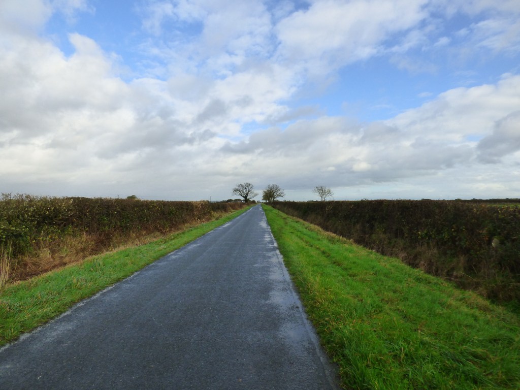
The rest of this walk is now pretty much all along roads, which should be easier going for my tired old legs. It starts off with Skinburness Road, which skirts the edge of the marsh.

The infrequent houses along this road have flood barriers instead of front gates!

I pass a derelict house where apples are growing in the overgrown garden. I don’t particularly feel like having an apple now, but they do look so tempting. I resist the urge.

I pass an old farm, where the barn has those same arched windows I saw earlier. A house a little further up the road has the same style.


The lane terminates at the B5302, which is a busier road than it sounds. Cars swish past me, mostly pulling well over to give me space. Occasionally, especially when traffic is coming in the other direction, they don’t bother. It seems that killing pedestrians is preferable to slowing down to allow the other traffic to pass. Oh well, I survive it. I reach the Italian Alpine village of Calvo…

Round the corner, my route should follow a footpath through a farmyard and over some fields, but the gate to the farmyard is locked, so I’ll have to climb over. Right at this point the heavens open and the wind picks up, and I struggle to protect my camera from the rain, stuffing it under my coat. I’m now getting very wet, so try to pull my umbrella from my rucksack and open it, one-handed, while a steady stream of traffic whizzes past me. Getting increasingly frustrated, I decide that I really can’t be bothered climbing over the gate, especially as when Ruth came this way she said the fields were boggy and waterlogged, and so I continue trudging down the B5302, swearing at any driver who comes within a couple of yards of me.
The rain stops and I instantly cheer up. The road isn’t too bad, not that busy really, and within ten minutes I turn off onto a quiet lane.
I’m starting to get a little fed up with walking along lanes, they just drag on and on. I get a song in my head that won’t go away, a real earworm. I try to think what the song is, and realise it’s off an old Donovan album I used to listen to when I was a teenager. Why on earth did my mind bring that up? I’ve found the most effective way to get rid of an earworm is to actually play the song, so I find it on my phone – The War Drags On. “The road drags on“, I sing along. That lifts my mood again, this isn’t so bad.
And sure enough, the roads do drag on. One lane turns into another, which turns into another, and another, nowhere near the sea. The sea is the other side of the salt marsh, which is the other side of all these farmers’ fields. The closest I get is a quick glimpse of the River Waver which these lanes are skirting. A footpath leads off here next to the river through the fields, but with all the rain recently, and how heavy my legs are feeling, I really can’t be bothered to attempt it, and stick to the lanes. The footpath may be closer to the coastline in theory, but there’s no sight of the sea anyway.

After a ten minute break sitting down on a wall, and something to eat, I arrive at Abbeytown, a small village named after Holme Cultram Abbey. At the far end of the village lies the abbey itself.

It’s had quite an exciting history, which I won’t bore you with, as you can read all that on Wikipedia. It was built in 1150, and was attacked at frequent intervals by Scottish border reivers, including at one time by celebrity reiver, Robert the Bruce. He decided to trash the place even though his dad was buried there – these celebrities have no respect. Following Bob’s example, in 2006 a local youth burnt it down and was sentenced to four years in prison for it. Just shows there’s one rule for the king of Scotland and one for everyone else. It’s been renovated since then, and inside is an exhibition with a model of how the abbey looked in its pomp. I couldn’t find the tomb of Bob’s dad though.


The lane continues to drag on and on until it eventually crosses over the River Waver, so narrow here, but so wide just half a mile further toward the coast.

I reach a fork in the road. My Komoot app says to continue straight on, keeping as close to the river as possible, but the signpost says turn right. I decide to stick closer to the river as the distance is much the same anyway. This narrower lane heads up a hill and over what was the Carlisle & Silloth branch of the LNER railway. Not much going that way now…

The lane eventually reaches the edge of Rabycote Marsh. I feel like I’m almost back on track. OK, there’s no waves breaking onto sand, but at least it’s coastal rather than farmal.

The lane passes a large pond at Salt Coates then arrives at another fork. “Turn left” says my app.


I’m not so sure, but I’ve come this way so what the hell. The lane becomes a track, then arrives at a gate. I pass through the gate, past a dodgy looking semi-abandoned house, then I’m directed to go into a field and turn right….

Now I’m convinced this is not right. I check on Google maps, but can’t see any form of track or path here. I haven’t got access to an OS map anymore so I can’t check. The only alternative route is a mile back now, and I really can’t be bothered to go back, so continue onwards…

Hmmm, I think I can safely say this is not a public footpath. In for a penny, in for a pound, I scale the barbed wire fence using the conveniently placed sloping wooden poles, and tramp across the next field where a gate leads onto a proper track again.
For anyone using my blog as a guide…. don’t go this way. [I’ve since edited the path in OpenStreetMap to remove this section, so Komoot won’t direct people this way anymore]

The track turns right, left, right, left, dancing around the corners of square fields, and through the yard of West End Farm. “West End Farm, do do do do-do-do-do” the Pet Shop Boys sing in my head…. oh not another earworm. Out the farm gate, and I’m back on the B5307.
Another mile along the road I finally reach my destination – Newton Arlosh. The village owes its origin to the misfortune of Skinburness which was swept away by violent storms in the 14th century. The inhabitants moved to a safer spot which became known as Newton Arlosh, meaning ‘New town on the marsh’. Its most famous feature is a tiny fortified church, the Church of St John The Evangelist, complete with battlements, crenellations, and arrow-slit windows to fend off any invading Scots that wander by.

It even has an eagle on the roof keeping a lookout for bands of dodgy-looking guys in kilts. Fortunately I didn’t wear one today, although I’d have been more concerned with that barbed wire fence than the eagle if I had.

This walk was completed on 24th October 2021, and was about 14½ miles long. Here’s my annotated map:

And here’s a real-time recorded map of my actual route, which you can pan and zoom around (just click on it if it’s moaning about WebGL, I don’t know why it’s started doing that).
Read some other coastal walkers’ write-ups for this section, just click on the image…


I like your humour. I never noticed Dick Trod lane, good spot. I remember the Skinburness Hotel as it was there when I did this walk and was in fact listed as the place where the bus stopped. No longer a hotel I figured this big derelict building was probably the right place (reminds me when walking in Cornwall when the bus company listed the stopping point as “Opposite Woolworths”, long after Woolworths ceased to exist, leaving me to guess which shop it might have been). A shame it’s gone now. The then and now picture is very clever and interesting (not that much has changed, really). Make me feel old that the hotel has gone, it doesn’t seem that many years ago!
As to getting songs in your head when I do a lot of road walking I usually end up with “He Aint heavy, he’s my brother” by The Hollies in my head owing to it starting with the words “The road is long, with many a winding turn…”.
I think you picked the right route, well apart from the bit that wasn’t a path at all, of course. If you zoom to the 1:50000 map on your Bing link you’ll see a path shown over Calvo Marsh. On my (not bang up to date) 1:25000 map this was the route of the Cumbria Coastal Way (which since seems to have been abandoned and remove from the maps). I tried to follow it, but a total nightmare of jumping over clumps of grassy tussocks and trying to avoid, not very successfully the boggy areas. Took me ages and I eventually gave up and followed as close to the fence as I could until I got to the road! So I’ll add another “don’t go that way” to your own!
Thanks Jon. The Skinburness Hotel was quite a local landmark by the sounds of it, it’s a shame it couldn’t be restored and used for something. I guess they don’t get many tourists up that way though, most people going to the lakes and mountains instead – and who can blame them, it’s not exactly stunning scenery around here.
I don’t often listen to music on the walks, only once before and that was trudging along a dual carriageway near Preston. Sometimes you need to take your mind off where you are!!! I wonder how many coastal-walk related songs we could come up with….. no, let’s not go there!!!
I didn’t mention the footpath over the marsh now I realise. I had thought about going that way when I was planning the route, but I think I saw a comment you made on someone else’s blog about your experience with it and decided against it on your advice, thanks for that! David Cotton also got soaked and muddy attempting it. There was one guy, can’t remember who now, who did attempt it and said he found it OK, but that seems to be the exception.
Just wondering, when do you think you’ll get to writing up this part of the coast on your blog Jon?
Yesterday 🙂
It seems to be an odd part of the country. Well done for persevering.
You had me down a rabbit hole of past tunes with your link to that dirge by Donovan. I’m’just mad about saffron.
Odd it certainly is BC. There are some very strange places on the coast. Banks in Lancashire felt very weird to me, and of course Sunderland Point is strange to the point of creepy! I think salt-marshes tend to make places a bit strange and edgy. Maybe it’s all those black and white films like Hound of the Baskervilles still haunting us!
Oh, and sorry for filling your head with earworms!
It looks like you did this walk just in time before the current bad weather arrived. And for those roads that seem to drag on and on you could sing ”The long and winding road” ”Road to nowhere” or even ”Road to Hell” 🙂
Oooooh no, let’s not go there! 🤣😂🤣
Great narrative Paul. The radio station comment had me chuckling when I was reading this in my tent on a stormy night earlier in the week! 🙂
Just read your write-up. Beautiful scenery but the less said about the weather the better. You’re a brave man camping out in this weather!!!